Wednesday, April 19, 2017

Topography

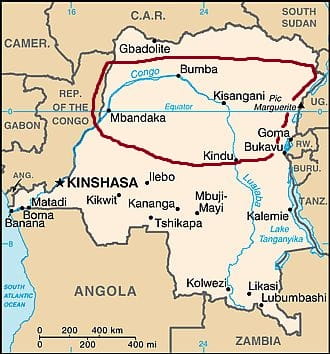
The Democratic Republic of the Congo has a very interesting mix of topography. The land goes from mountains near 8000 feet in the far east to the  coast that falls into the sea. The country has two main watersheds, the Zaire and the Ogooue, which are separated by the savanna of the Plateau region. This Plateau region is one of four topographical region that divide the country, the rest of which are the Coastal region, the Escarpment region and the Northeastern region. The Plateau region is located centrally in the country and has a rough elevation of 3000 feet. South of the Plateau region is the Escarpment region which is distinguished by long narrow furrows stretching parallel with each other out towards lower elevation. These furrows are almost entirely forested and stand between 2000 and 3000 feet in elevation. The Coastal region is tucked away in the south west corner of the country aptly on the coast. This region consists of mostly low lying treeless plains with occasional spurts from the Escarpment region. Finally there is the Northeastern region which consists primarily of swampland and stand about 1500 to 1600 feet in elevation. This region is a major flood zone because of the numerous tributaries that run through it and the low elevation. If you can picture the flow of this land it may look just as diverse as the ecology of it jungle.


"Congo, Republic of the (ROC) - Topography." Encyclopedia of the Nations. N.p., n.d. Web. 19 Apr. 2017.


Tuesday, April 18, 2017

Geography

Author: TUBS
The Democratic Republic of the Congo (DRC) is located in western and central Africa. It is the second largest country in Africa behind Algeria.  The DRC is a little bigger then the State of Alaska and would fit with in the plain’s states of the continental United States.  This country has only 25 miles of coast line on it’s western border.  The Democratic Republic of the Congo has 2,344,858 sq km within its borders.  The Democratic Republic of the Congo borders is small enough to fit within the continental United States.  The Democratic Republic of the Congo is bordered by nine counties. The countries that neighbor the DRC are Angola, Burundi, Central African Republic, Republic of the Congo, Rwanda, South Sudan, Tanzania, Uganda, Zambia. One of the DRC’s most important and impactful is Rwanda.  Rwanda is a very unstable and has many problems with rebel groups these group usually hide in the jungles of the DRC.  There has also been a very unstable relationship between both governments due to race.  Over the last 20 years the country have been fighting back a forth to put different leaders in power.  The capital of the Democratic Republic of the Congo is Kinshasa and is located in the western part of the country.  This poses a problem for the country because its power starts to fade as you get farther east.  The Democratic Republic of the Congo claims 12 nautical miles of the ocean.  The Democratic Republic of the Congo is located right on the equator the latitude is 0° North and the longitude 25° East.  A major river system in the Democratic Republic of the Congo is the Congo River. The Congo river is the second largest river Africa only to the Nile.  The Congo river has thousands of miles worth of shipping lanes on the river.  The Congo also is the most powerful river in Africa and has about 40 Hydroelectric plants along it.


"Congo River Facts." CONGO RIVER FACTS. N.p., n.d. Web. 18 Apr. 2017.
"Stop Messing Each Other up." The Economist. The Economist Newspaper, 03 July 2012. Web. 18 Apr. 2017.
"Q&A: DR Congo Conflict." BBC News. BBC, 20 Nov. 2012. Web. 18 Apr. 2017.
Sautter, Gilles François, and Roland Pourtier. "Congo River." Encyclopædia Britannica. Encyclopædia Britannica, Inc., 21 Aug. 2009. Web. 18 Apr. 2017.


Sunday, April 16, 2017

Climate of the Democratic Republic of the Congo

Democratic Republic of Congo Climate
In the DRC the climate is equatorial, that is, hot and humid all year round with no dry season in the central area crossed by the equator where there is a vast rainforest or tropical, that is hot all year round with a dry season, one that is short in the areas north and south of the equator. The dry season occurs in opposite periods, from December to February (boreal winter) north of the equator and from June to September (austral winter) in the southern part.
The rains occur in the form of downpour or thunderstorm; in fact, the Congo receives the most lightning strikes in the world. Usually the rain comes in the afternoon, all year round in the equatorial zone and in the long rainy season in both the tropical areas.

The average temperature in the equatorial climate year round hovers between a maximum of 84-88 degrees and a minimum of 66-68 degrees. With precipitation averaging around 74.4 inches each year.

In the tropical climate the average maximum temperature is 84-91 degrees and the minimum is usually between 66-70 degrees. On average, throughout the year this region receives about 65 inches of rain.

In the tropical climate with a long dry season the average maximum temperature is between 77-86 degrees and the minimum is between 64-73 degrees. Even with the dry season this region still gets about 30.7 inches, on average, of rain each year. Also in this region is the coastal section, here the average sea temperature sits between 72-81 degrees’ year round.


In the mountains the average temperature sits between 75-77 degrees and the average rainfall around 49.8 inches.

Saturday, April 15, 2017

Ecological zones

Congo rainforest by FabMoustic
Overview: 
The Democratic Republic of Congo is composed of a wide varied ecological zones and biomes including forests, grass lands, savannas, mangroves and fresh water ecoregion. Each area throughout Congo contains different characteristics, vegetation and species.  

Rainforests 
The Congo rainforest, including Northeastern Congo Basin Moist Forests, Central Congo Basin Moist Forests and Western Congo Basin Moist Forests in The Democratic Republic of Congo, but also covering many parts of Africa, such as  Cameroon, Equatorial Guinea, Gabon, the Central African Republic is one of the larges rainforests in the world. The Congo rainforest is 18% of the worlds rainforest, making second in line right under the Amazon rainforest. Over half of the DRC is the rainforest, making it a key ecoregion to the country. Many species such as primates, including chimpanzee, gorillas and moneys call this area their home.

Mountains Forests 
The Albertine Rift montane forests contain the larges numbers of the endangered mountain gorilla seen anywhere else. It's also home to thousands of different plant and tree species, with some only found in the local area. 


Savana by Mark Marathon

Savannas and Shrublands
Comprised of low flat land and some rolling hills, Central and Eastern Miombo Woodlands and the Sudanian Savannas make an ideal home for many large mammals like  giraffes, elands, rhinos and African elephants. With very little water, land in these areas is vastly dominated with grass rather than trees. 
Zambézia Province by COSV

Flooded grasslands and savannas 
Many mammals travel miles to the Zambezian Flooded Savannas seasonally for water but it's floodplains are vastly inhabited by Waterbuck, Puku, Lechwe, Hippopotamus, and the Sitatunga. 

Mountain Grasslands and Shrubland

The East African Moorlands is an essential ecoregion for many species of birds with its high altitudes abundance of water. This area is depended on for migratory birds and birds that inhabit it while wintering there. 

Mangroves

Mangrove by Natalieragan
The Gulf of Guinea Mangroves serves as shallow line where water and land meet. It is a safe breeding area for many shrimp and fishes, as well as home to many other species that prefer its shallow waters, such as West African manatee, African slender-snouted crocodile, Nile crocodile and Cape clawless otter. 

Freshwater ecoregion: 

Rivers and Lakes
The Democratic Republic of Congo has an abundance of freshwater ecoregions including the Congo River and Flooded Forests, Congo Basin Piedmont Rivers and Streams, Gulf of Guinea Rivers and Streams, and the Rift Valley Lakes. Some of theses rivers stretch from the center of the continent all the way to the ocean, contain over 700 fish species and a high density of amphibians.  

Sources: 
"Yale University." Congo Basin Ecoregions | Global Forest Atlas. N.p., n.d. Web. 19 Apr. 2017.
"Central Africa: Democratic Republic of the Congo." WWF. World Wildlife Fund, n.d. Web. 19 Apr. 2017.